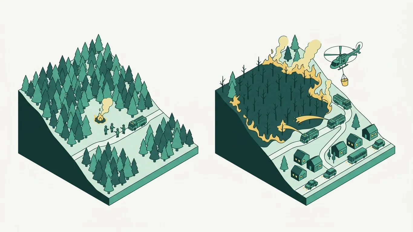
Every wildfire has an hour that decides everything. Caught inside it, a fire is a local incident handled by one crew with hand tools. Missed, it becomes a regional emergency, with aircraft and evacuations, and a burn scar that will still be visible from orbit in ten years.
The whole discipline of early detection is an argument about how to spend that hour. And the argument turns on one physical fact that is easy to overlook: a fire becomes chemically detectable well before it becomes optically detectable.
A fire starts as chemistry, not as flame
Put a heat source against dry pine litter and nothing dramatic happens at first. The material does not ignite; it decomposes. Cellulose and lignin break down under heat and release gas. This is pyrolysis, the stage that precedes visible combustion.
What comes off is not smoke in the everyday sense. It is a mixture: hydrogen, carbon monoxide, and a wide family of volatile organic compounds released as the plant tissue comes apart. Fire-safety research has been mapping this sequence for years, and the ordering is consistent. Hydrogen sensors have been shown to respond to pyrolysis before carbon monoxide and smoke reach detectable levels. Carbon monoxide follows, but needs a large enough smouldering nest to accumulate, which means CO alone costs you time. Metal-oxide sensors, meanwhile, react to the whole VOC mix, which is why they have been used in “electronic nose” fire detection for decades.
So the sequence on the forest floor runs roughly like this:
- Heat source meets fuel. Nothing visible.
- Pyrolysis begins. Hydrogen and VOCs start leaving the material.
- Smouldering establishes. Carbon monoxide accumulates.
- Flame appears. Now there is heat and light.
- A plume forms and rises above the canopy. Now there is something to photograph.
Optical detection (every camera, every satellite) starts working at step five. Gas sensing starts working at step two.
Three detection windows
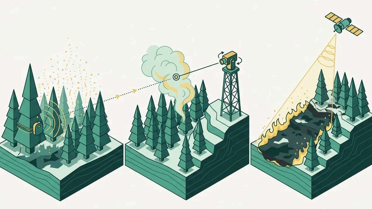
The three technologies people compare are not competitors so much as three different clocks. It helps to see them side by side.
| Method | What it needs | Realistic window |
|---|---|---|
| Gas sensing inside the stand | Air movement from the source to the sensor | Minutes, during smouldering |
| Camera on a tower | A plume above the canopy, clear line of sight | Tens of minutes, daylight-dependent |
| Satellite | A thermal signature filling enough of a pixel | Tens of minutes to hours, orbit-dependent |
The satellite row deserves a footnote, because “satellite detection” covers two very different things. Polar-orbiting instruments such as VIIRS have useful resolution (375-metre pixels, capable in good conditions of flagging fires under 0.2 hectares), but they pass over a given point roughly twice a day, and the imagery then takes one and a half to two and a half hours to become available after observation. Geostationary instruments refresh every ten or fifteen minutes instead, but their pixels are kilometres across, so a fire has to be substantial before it moves the number.
Cameras sit in between and do a good job: modern smoke-detection systems work reliably at fifteen to twenty-five kilometres. But they inherit the geometry of the landscape. A ridge between the tower and the ignition point is an absolute blocker. So is a valley whose floor a tower cannot see into, and so, in practice, is night combined with the wrong kind of fog.
None of this makes optical detection bad. It makes it late, and blind in specific, predictable places.
Why the sensor has to be in the forest, not above it
Here is the part that is easy to get wrong. Gas sensing is not simply “a better sensor”. It is a bet on being physically close to the event.
Pyrolysis gases disperse. Concentrations that are obvious at two metres from the source are indistinguishable from background at two hundred. That is why the useful question is not “how sensitive is the device” but “how much forest is within reach of a device”. Sensitivity is just a line on a component datasheet. Whether the system works is decided by coverage, and coverage is a network design problem.
This is why we describe Velaya in terms of coverage per sector rather than in terms of parts. A single very good sensor on the wrong ridge detects nothing. A grid of adequate sensors across the sector detects the ignition wherever it happens to start, including in the drainage the tower cannot see and on the north slope at three in the morning. You can read how the layers fit together on How it works.
There is a second, quieter advantage to being inside the stand: the sensor sees the fire’s environment as well as the fire. Temperature, humidity and the way they have moved over the previous days are not detection signals on their own, but they are exactly the context that tells you whether a rise in VOCs is worth waking someone up for.
The hard part is not detecting. It is not crying wolf
Any honest article about gas sensing has to spend a paragraph on false positives, because the forest is full of things that emit volatile organic compounds and are not fires.
A diesel engine on a forest track. A barbecue at a picnic area. Agricultural burning two valleys over, on a day when the wind is doing something unhelpful. And there is the one people forget: pine forest itself, which emits terpenes, and emits far more of them when it is hot and stressed. Which is to say: precisely on the days when fire risk is highest, the chemical background is also at its noisiest.
An alert system that fires on every VOC excursion will be switched off by the people it is meant to serve within a fortnight. That is not a hypothetical failure mode; it is the standard one.
The countermeasures are unglamorous and mostly not about the sensor at all:
- Rate of change matters more than absolute level: a fire produces a rise with a characteristic shape, while a hot afternoon produces a slow drift.
- Several gases are read together: a single-species spike is noise, and a coordinated move across several species is a fire signature.
- Neighbours act as witnesses: one device reacting is a hypothesis; two adjacent devices reacting in a pattern consistent with wind direction is evidence.
- Every device learns its own local baseline, because a north-facing pine slope and a scrubby south-facing one are not the same chemical environment.
- An alert that will move vehicles and people gets visual confirmation first: the last step is an eye on the coordinates.
That last point is why our design pairs the sensor layer with a station layer that can put a camera over the location within minutes. The sensors decide where to look, the confirmation decides whether to go, and neither is much use alone. The three layers are described on Solutions.
What this actually changes on the ground
Suppose a fire starts at 03:40 in a drainage with no road, four kilometres from the nearest tower and out of its line of sight.
Under optical-only detection, the first useful signal comes when the plume clears the canopy and becomes visible, or at first light, whichever is later. By then the fire has had hours in exactly the conditions that favour it: low humidity, cool dense air, terrain that channels wind uphill.
Under gas sensing, the first signal comes from the drainage itself, in minutes, with coordinates attached. The crew that arrives is small, the tools they need are hand tools, and the incident does not get a name.
That is the entire argument. Not that gas sensing is a more advanced technology than a camera (it is in many ways a cruder one), but that it operates in a window the camera cannot reach, in the places the camera cannot see, at the hours the camera is worst.
We are building and testing this network in the Mediterranean, and we publish what the tests show rather than what we hope they will show. If you manage municipal woodland, a power corridor or a natural park and you have a sector where the towers do not reach, we would like to talk.
Sources
- Fire Safety Journal: Early fire detection: are hydrogen sensors able to detect pyrolysis of household materials?
- Chemical Engineering Transactions: Detection of smouldering fires by carbon monoxide gas sensors
- Fire (MDPI): Satellite detection limitations of sub-canopy smouldering wildfires
- US GAO: Science & Tech Spotlight: wildfire detection technologies